
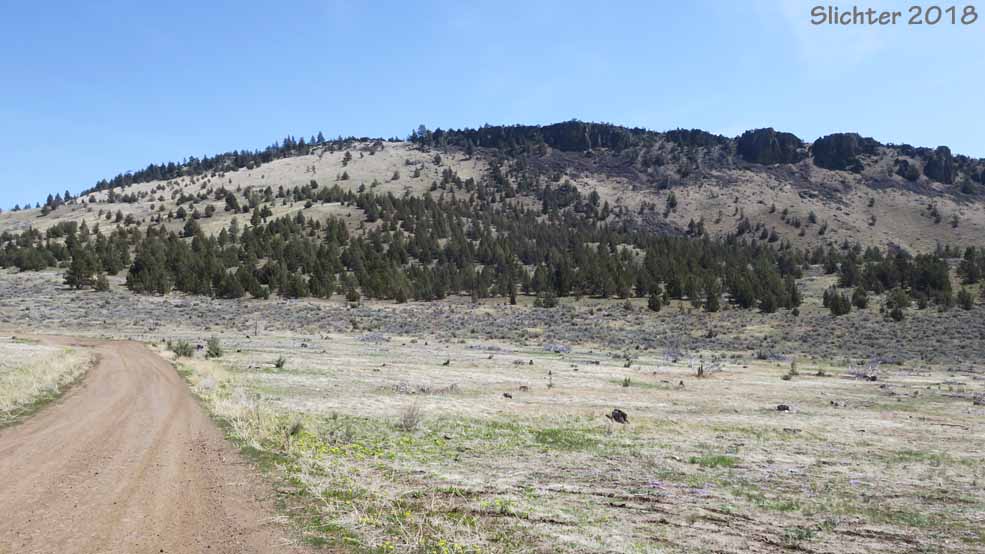
 Pine Ridge is a basalt ridgeline located immediately east of Gray Butte in the Crooked River National Grasslands. Its 2 mile ridgeline oriented from southwest to northeast. It can be accessed by hiking north from the Skull Hollow Campground or from its northern slopes, which are more gently sloped. There are no trails, so this is all cross country walking through dry ponderosa pine and juniper forest or up bunchgrass slopes. Many of the Cascade peaks can be viewed from different parts of its summit, from Mt. Hood in the north south to Mount Bachelor. Few people seem to visit Pine Ridge, although it sees some use as a launch point for paragliders. One may also encounter some cattle on the ridge and around its base as well as ATVs, and target shooters, although most recreationists tend to stay on the road..
Pine Ridge presents a good opportunity to see the native flora of the High Desert of central Oregon with a fairly natural flora, especially on the steeper slopes away from the roads.
From the North: From US Highway 26 between Madras and Prineville, turn south onto paved Lone Pine Road. After about 0.1 mile, just past the Pine Ridge Corral (wooden with numerous young pines growing in it), turn right onto Forest Road 57 which is an unimproved dirt road which can be greasy early in spring or after summer showers. Drive west along the base of the north-facing slopes of Pine Ridge, staying straight and on the main track of Road 57. Begin looking for pullouts or tertiary roads that provide places to park betwen 1.5 and 2.7 miles along Road 57. If you reach Forest Road 5710 (probably unsigned) which ascends up a valley from the south between Pine Ridge and Gray Butte, you've gone to far. The west side is steeper to ascend.
From the South: From the north end of Redmond, OR, drive north a mile or so on US Highway 97 and turn right (east) onto Oregon Highway 370 (Oneill Highway). At 0.4 miles (from US 97), stay left on OR 370. After another half mile, stay right on OR-370. After another 4 miles, turn left (north) onto Lone Pine Road. Drive north on Lone Pine Road about 1.3 miles to a T-junction, staying right (east) and continue about another 4 miles to the signed junction for Skull Hollow Road (Forest Road 5710) on the left. There's a primitive campground with vault toilets that stretches about a mile north along Skull Hollow Road which is graveled and in mostly good shape the first 2 miles. The road gets progressively worse the farther north one drives up the canyon, with some deep pot holes on tight uphill turns. The upper part of Skull Hollow Road probably should not be driven by passenger vehicles in early spring or after summer downpours. One eventually drives into a clearing and arrives at a T-junction. Take the right fork and begin looking for safe places to pull over to hike the gentler, bunchgrass slopes on the north face of Pine Ridge.
From Terrebonne, OR: From near the center of Terrebonne, OR, turn off of US Highway 97 and head east on Smith Rock Way for about 4.8 miles where you stay straight where the road joins Lone Pine Road. Contine as above on Lone Pine Road until reaching the junction with Skull Hollow Road, or continue north to Forest Road 57 which is about 0.1 miles south of US Highway 26.
There are no facilities (vault toilets, picnic tables nor potable water) on the west, northwest and north sides of Pine Ridge. Vault toilets may be found at the Skull Hollow Campground at the southwest corner of Pine Ridge.
Do not leave valuables in your vehicle. The area should see a lot of weekend traffic, so it is best to be safe!
April 24, 2018: Pine Ridge via the northwestern slope to the ridgetop. (Crooked River National Grasslands)
 -
-
 -
-